The urban development of villages adjacent to the border of Prague is unstoppable. Updated and new zoning plans include new areas to be developed. Since the 1990s there has been a growing need for new housing within easy reach of the capital. Despite the minor stagnation of recent years, job opportunities are driving more and more people to Prague.
The explosive development of urbanization at the turn of the 20th and 21st centuries brought with it a very unfortunate experience and the omission of the very fundamental rules of how to create living space. The principles of socialist urbanism were abandoned without compensatory measures. In place of the new rules being introduced, the land fell prey to the gold rush fever of the building boom, which allowed the territory to be openly plundered. Today, the projects started in those days have already begun bearing somewhat tainted fruit. Communities without a properly developed infrastructure, the constant need to live on the move, totally neglected public spaces and, last but not least, the destruction of green spaces as an integral part of our lives and, above all, those of other species that share this space with us.
Efforts to regulate old zoning plans and find ways to restore the disturbed balance have been very clumsy. By strictly dictating roof pitches and plot sizes, they did not in principle respond to the real problems that urban planning involves. Restrictions were more or less killing innovative perspectives on space creation and, above all, did nothing to motivate investors to enhance their own investments beyond the demarcated area of the planned buildings.
Therefore, it is vital for the current understanding of urbanism to start changing. Thanks to the very innovative approach of ing. arch. Starčevič, a zoning plan produced in Přezletice leaves room to search for answers to the above-mentioned issues. The open concept of the zoning plan with a minimum of regulatory interventions allows a new perspective on the formation of individual parts of the village.
When looking for a solution for the Ctěnický háj site, we tried to create the necessary balance between the interests of the investor and the interests of the village. History has shown that restrictions do not bring any benefits to the landscape. The investor's motivation to build a more interesting urban complex with a varied mix of units on offer and an effective density of development brought with it a willingness to create public space that did not end up with just concrete roads and pathways between houses with no greenery, with no public areas for residents to use, without respect for the existing paths in the place, and with no protection of the landscape permeability for the wildlife that share this piece of the land with us.
The entire concept of Ctěnický háj and its individual parts draws as much as possible on the knowledge and principles of sustainable development.
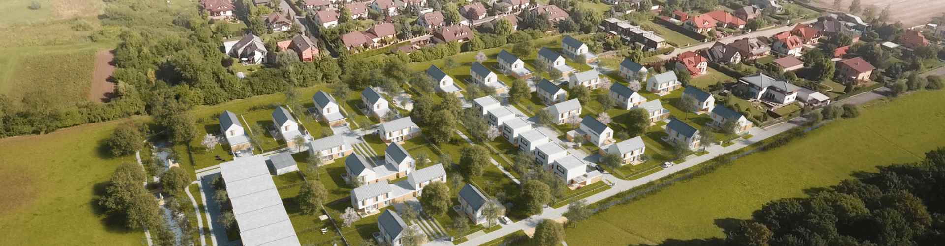
The urban design concept seeks to conceive the newly developed area as a fully functional unified complex that will create a valuable space for living inside it and at the same time will enhance and extend the user value of the adjacent sites while minimizing the impact of the development of the area on its surroundings. It is based on ecological and sociological rules as well as the principles of urban space design.
The imaginary boundaries between the countryside and the city have long since been removed. The standard of living of residents has aligned to the same level; the lifestyle of the villages adjacent to the borders of the capital city has undergone a fundamental change and in fact has unofficially erased these borders. The new localities need to be viewed as new residential districts of the suburban part of Prague, while holding onto their own historical continuity.
The key objective was to create a diversification of individual urban areas and their purposes in order to achieve a balanced combination of residential functions with public space, areas for relaxation with a connection to the open landscape not only for the site itself, but also for the entire adjacent territory, taking into account the ecological impact on the locality.
Our idea was to set up a hierarchical transport system, a street area dedicated primarily to people, with open green patches to be used as relaxation zones and spaces designed for active movement and leisure time.
The basic principle of the urban design is the SUSTAINABLE DEVELOPMENT OF THE AREA.
We view the newly designed residential quarter of the village as an organism that has many functions necessary for its own existence and also for proper integration with its surroundings and nature.
Historically, the development of a site was closely linked to its basic functions of use. Agricultural production fundamentally shaped the needs of urban planning. Large expanses of arable land belonged to farmsteads and smaller estates, forming rings of cultivated countryside around the villages. With the advent of the urban standard of living and the shift of the main work activity to towns, villages began to change their appearance geared towards organizing their land to serve more of a residential and recreational functions rather than economic ones. Since the 1930s, larger parts of villages have been developed as residential, focusing on individual construction.
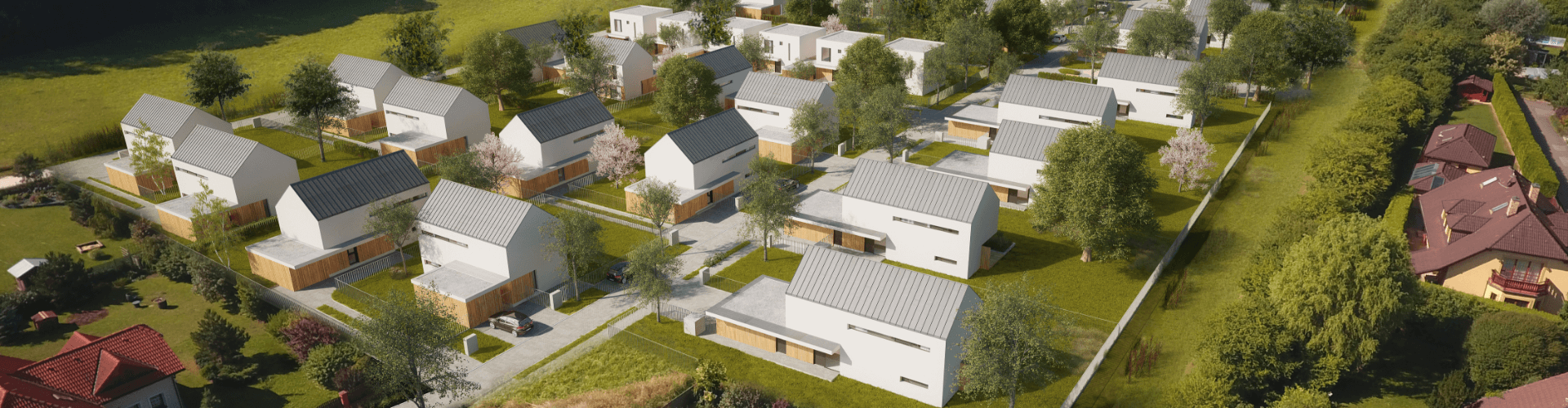
With the renewed awareness of the value of land, the perception of the area needed for individual residential buildings started to change. The initial urban planning structure of land development counted with a minimum utilisation share of square meters per person. Given population trends, this approach is now no longer sustainable in the long term. With the rise in the population curve, it is currently of public interest to guide development in the spirit of efficient land use. If we are setting aside valuable arable land for the growing needs of urban development, we must foster its most efficient use. A fundamental difference from historic patterns of settlement is the shift from dispersed individual buildings to more concentrated forms of urbanism. Therefore, we were looking for a suitable mix of smaller plots for individual detached and terraced houses for our project. Simultaneously, it is necessary to realize that the construction of apartment buildings of an appropriate scale, compared to individual family houses, allows for more efficient use of the built-up area while creating a space around the buildings that can continue to fulfil its ecological function with the additional possibility of being involved in the public life of the place. Hundreds of square metres of land are thus not just reserved for a few individuals, but remain available for use by the many.
The Ctěnický háj project is located in a place of significant natural landform. In geomorphological terms it is a shallow valley, situated between the original old residential parts of Přezletice and Vinoř. The area under development has four forms of demarcation:
The connection of the northern and southern boundaries through the natural area of the park is another important element of the urban design. The existence of the current link between Ctěnice Grove and the original western development of the village motivated us to position the central public space on it. This park, with its various forms of use, aptly complements the path to the forest, creating a place of relaxation and sports enjoyment as well as children's play area. The resulting division of the development area into two parts by the park also gives the entire residential complex a more intimate character.

In the past, thanks to more dispersed development and a greater proportion of the natural landscape, it used to be common for the temperature change between day and night to be balanced. Temperatures of heated air from the urbanised area alternated regularly with cool air coming from the open land. Natural circulation provided a comfortable environment while maintaining a stable ground surface temperature. Today, dense built-up areas without compensatory temperature surfaces have created the principles of heat boilers in residential complexes and thus interrupted the natural circulation of temperatures. Endless parking lots without trees, wide asphalt roads and the use of dark building materials, all contribute to the temperature destabilization of the environment as a whole.
From the point of view of monitoring the increase in the temperature of the ground surface, this fact should be taken into account at the outset of the urban planning. The design itself must respect and very carefully consider the use of warm and cold materials and incorporate solutions to create a stable environment by minimizing overheated areas.
The Ctěnický háj project extends the green area as much as possible. It envisages planting the sides of roads with tree alleys, minimizing the expanse of parking spaces and placing them between green islands of retention surfaces for rainwater capture. Water evaporation is another factor in regulating the site temperature. General areas of public space contain a green vegetation mix to slow surface water runoff from the site.
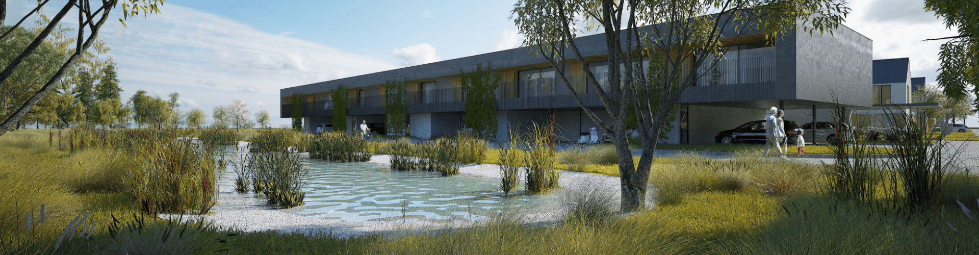
In direct relation to addressing the heat issues of the site, it is necessary to consider the problem of water drainage from the urbanised land. It used to be the practice to drain all surface water from paved areas immediately through pipe systems and take it away. In the long term, this trend has shown that the land then suffers from drought and water has to be returned to it by costly forms of artificial irrigation. We need to start realising that water is essential for the development of any place, including residential areas, both in the direct form for watering vegetation and as a secondary climate regulator.
Therefore, we have designed the surface water disposal system so that maximum water remains in the site as moisture, which is directly processed by the green mass in the retention areas, and at the same time humidifies the living environment by evaporation. Additional disposal in a form other than consumption, seepage or evaporation has been addressed as a backup in case of the actual consumption being insufficient.
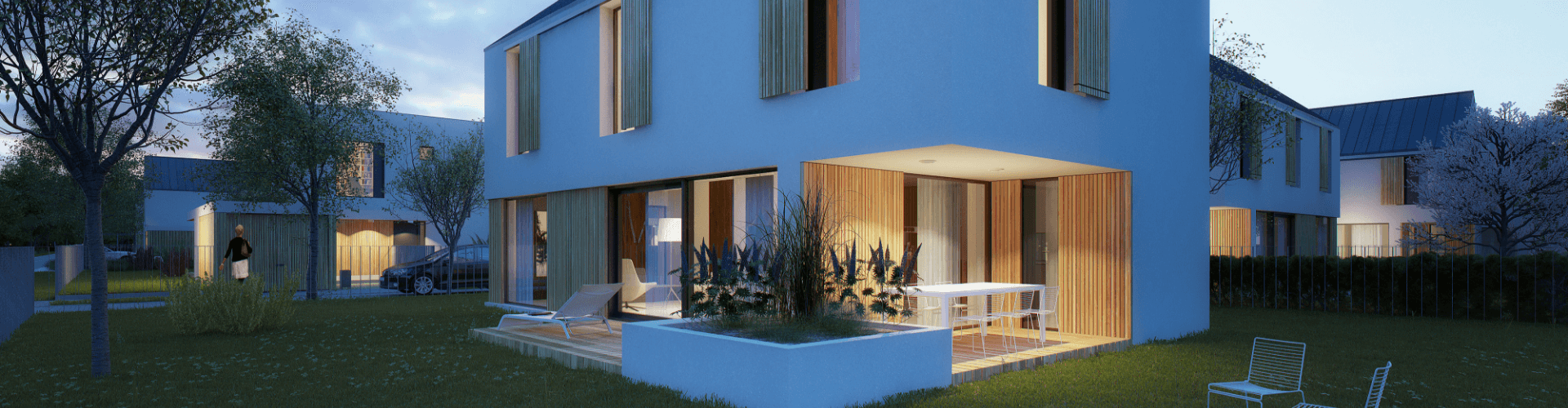
The intention to optimize the energy potential of the Ctěnický háj project is directly related to the chosen form of its urban content. In the context of energy saving, it is important to realize that the whole process does not have to start with replacing a boiler with a solar panel. Having the appropriate form of the housing units, the correct shape of the buildings and taking advantage of the orientation of the houses are factors that optimize the energy potential.
Today it should go without saying that the individual designed structures have minimum energy requirements, they use renewable energy sources and passive energy gain. All buildings within the project were designed as so-called passive houses - exceedingly energy-efficient buildings with very low energy consumption at the class A rating.
A suitable urban composition with efficient use of space frees up land to then be employed as part of the public realm, which is defined as streets, public green spaces, paths in the locality and areas of natural formations such as retention areas, etc. By allocating these spaces with sufficient dimensions we have directly determined the quality of the place and its use. Thus, we have tried to harmonize the appreciation of the finances invested in the project with the satisfaction of public interests, the interests of the village and its residents.
The creation of public space is also directly related to the problem of transport optimization. Although we are talking about the differences between detached housing estates in the city and the neighbouring villages disappearing, some elements of the transport infrastructure need to be protected. In smaller villages, the street should be seen as a place for the movement of residents. The distinction between pavements and roadways is often blurred because of the character of the place. One of the other benefits of our project is addressing transport issues on our actual property. We have designed the street space making sure it will not become a dumping ground for vehicles, but will be a naturally quiet lane beyond the fence line where the life of the community can be extended. The behaviour of drivers is indeed predetermined by the concept and the optimal dimensions of the streets.